Building a Simple Map View – Geospatial Data with Metatron Discovery 2
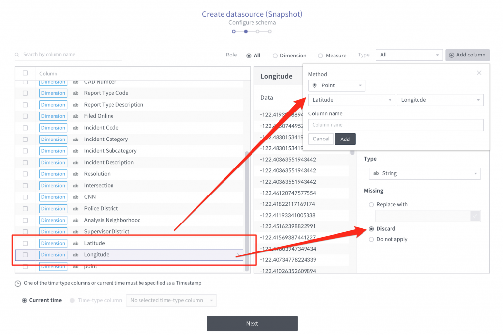
We’ve introduced how to load point type geometry data source and creating multilayers in our previous blog article: Analyzing geospatial data with Metatron Discovery This time we’ll discuss further – about applying polygon data, one of the geo types, and building a more concrete geospatial analysis with it. 0. Use case I like the city…
Read more